Rabat-Salé Tramway map
The official network map of the Rabat-Salé Tramway — both lines in service and every station. Download the PDF or zoom in on the image.
Information updated: July 2026
Official Rabat-Salé Tramway network map
High-resolution diagram of the Rabat-Salé Tramway: Line 1 (red) and Line 2 (blue), the 42 stations and the five-station shared central section — Bab Lamrissa, Pont Hassan II, Place du 16 Novembre, Tour Hassan and Place Al Joulane.
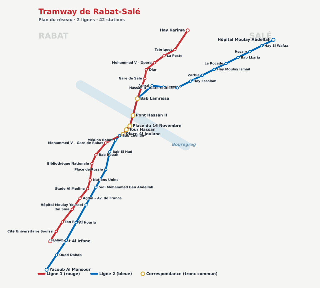
Map by Wikimedia Commons contributors · Released under the CC-BY-SA licence.
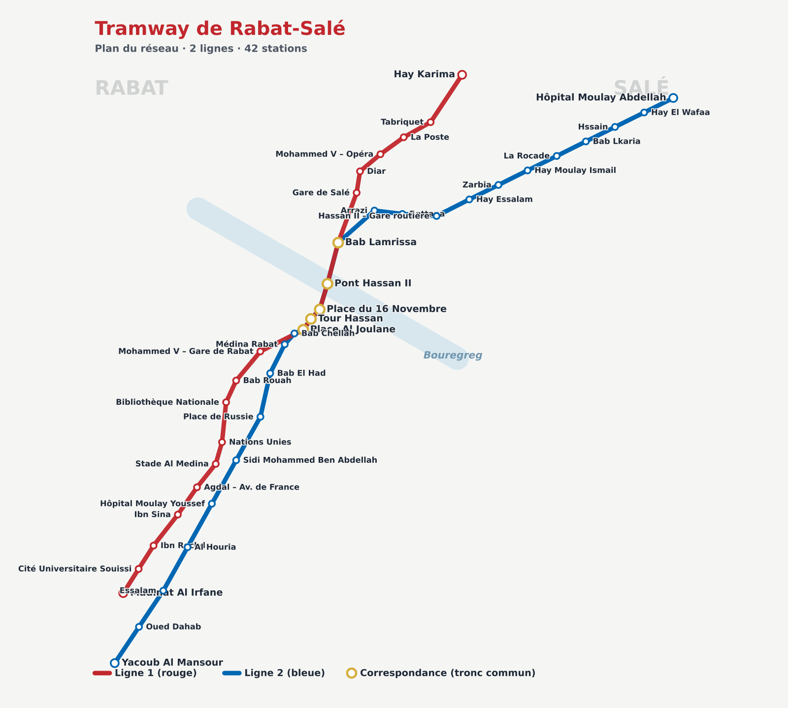
Line colours and legend
Line 1Hay Karima ↔ Madinat Al Irfane
In serviceLine 2Yacoub Al Mansour ↔ Hôpital Moulay Abdellah
In serviceShared central section5 stations shared between L1 and L2 via the Pont Hassan II
SharedLine diagrams — every station
A clickable diagram of each line in service, in order, with interchanges and terminus stations shown.
Line 1
Line 1 · Hay Karima ↔ Madinat Al Irfane
Hay KarimaTerminus
Bab LamrissaInterchange · L2
Pont Hassan IIInterchange · L2
Place du 16 NovembreInterchange · L2
Tour HassanInterchange · L2
Place Al JoulaneInterchange · L2
Madinat Al IrfaneTerminus
Line 2
Line 2 · Yacoub Al Mansour ↔ Hôpital Moulay Abdellah
Yacoub Al MansourTerminus
Place Al JoulaneInterchange · L1
Tour HassanInterchange · L1
Place du 16 NovembreInterchange · L1
Pont Hassan IIInterchange · L1
Bab LamrissaInterchange · L1
Hôpital Moulay AbdellahTerminus
Service monitoring
Rabat-Salé tram status
Service status · updated in real time
1OK
Ligne 1 · Hay Karima – Madinat Al Irfane
Normal service
2OK
Ligne 2 · Hôpital Moulay Abdellah – Bettana
Normal service
Normal serviceMinor delaysService suspendedOutside service hours
🚊
Before every trip, check the tram statusSave this page to your favourites and check it to travel informed: you’ll see at a glance if any line has issues.